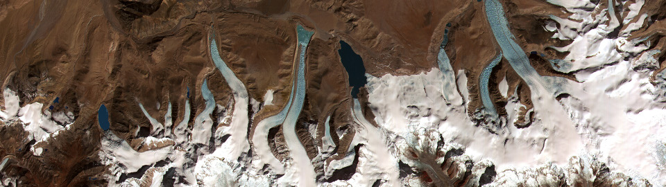


S:GLA:MO (Slope Stability and Glacial Lake Monitoring) is an ESA funded project (ESRIN/Contract No. 4000110404/14/I-BG). Its aim is to provide a service that provides an integrated assessment of hazards related to glacial lakes that addresses the widely acknowledged dependencies, integrated detection, monitoring and modelling of glacial lakes together with detection, monitoring and modelling of slope instabilities and glacier conditions and behavior that potentially affect the glacial lakes. The project is organized in 3 tasks described below.
Task 1: Technical Specifications and Demonstration
The aim of Task 1 is to conduct a pilot study (service demonstration) that demonstrates the GLOF glacier lake monitoring system. The system is designed to be generic so that it can be implemented for any worldwide case in Task 2.
Task 2: Service Implementation
Task 2 consists of the work packages WP2100 (Service Implementation and Product Generation) and WP2200 (Product Validation). Following the experience made in Task 1 and documented in D1 and D2, the system is adapted to the end-user sites, based on the user feedback, data availability, and acceptance by ESA.
Task 3: Service Evaluation and Evolution
Work of Task 3 is organized in WP3100. The goal of the project is not only to establish a running service in the frame of this project but to find a possibility to continue the service and enhance the geographic coverage and user group. For that purpose the service is evaluated for a regular monitoring phase together with the end-users and strategies for a continuation are outlined.

Figure: Task Plan.


